Sierra de Guadarrama day trip from Madrid: hiking & nature guide
How do I get from Madrid to the Sierra de Guadarrama for a day hike?
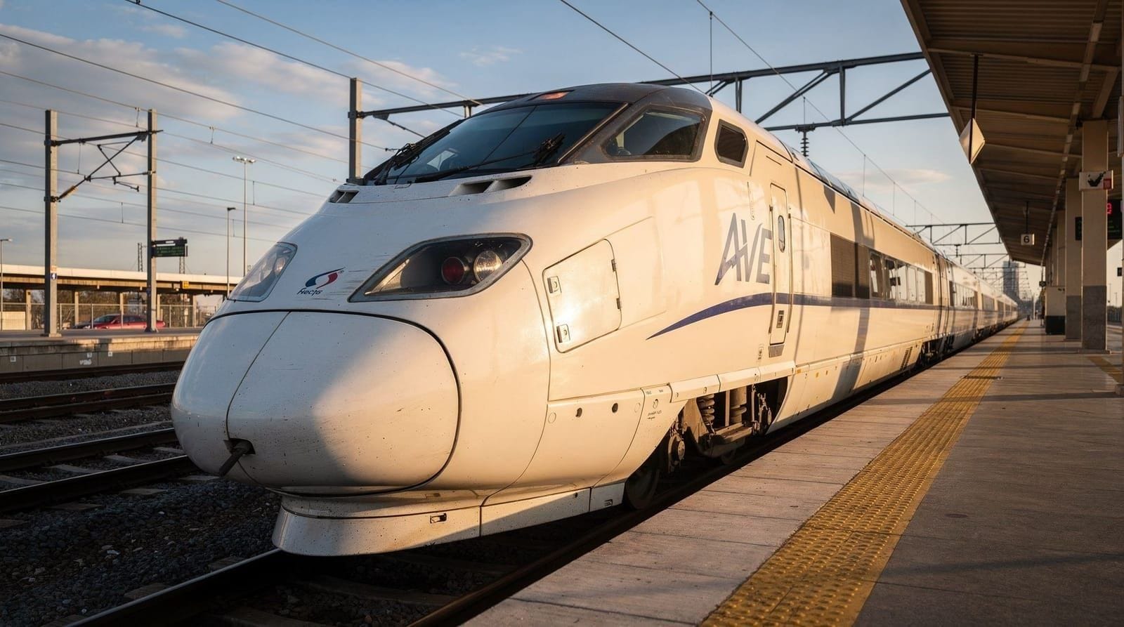
Cercanías C-8 train from Madrid Atocha or Chamartín reaches Cercedilla in about 50 minutes (€4–5, Tourist Travel Pass may be valid). From Cercedilla, the Tren de la Naturaleza narrow-gauge railway (seasonal) connects to mountain trailheads at El Ventorrillo and Puerto de Navacerrada. Alternatively, Cercanías C-8a reaches Navacerrada (the ski resort / alpine village) in about 1 hour 20 minutes. Both give access to Sierra de Guadarrama National Park walking trails without a car.
The mountains above Madrid
Madrileños have been coming to the Sierra de Guadarrama to escape summer heat since the 18th century. Philip II built El Escorial in the foothills. The Casa de Campo was a royal hunting ground. Today the Sierra de Guadarrama National Park — designated in 2013, 340 km² of protected mountain — is one of the most accessible wilderness areas of any major European capital.
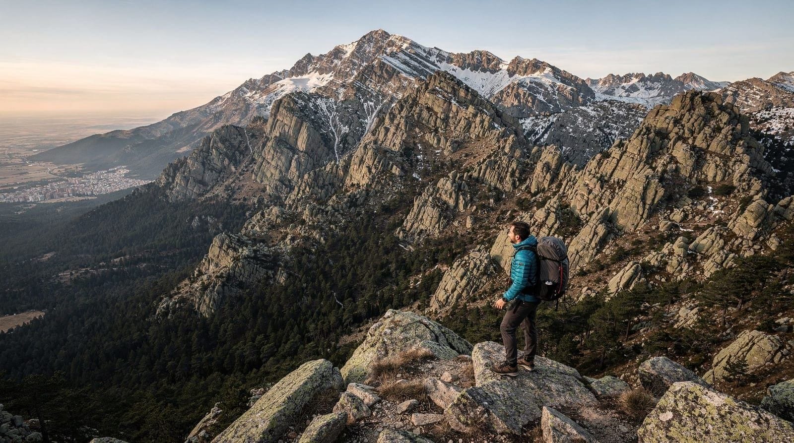
The granite peaks visible from Madrid’s rooftops on clear days — Peñalara, La Mujer Muerta, the Siete Picos range — are between 45 and 90 minutes away by train or car. The temperature difference between Madrid at 650 m and Peñalara at 2,428 m means that on a July day when the capital bakes at 38°C, the Sierra summit can be a comfortable 22°C.
This guide covers how to access the Sierra for a day hike from Madrid without a car.
| Where | Sierra de Guadarrama National Park, 45–90 min northwest of Madrid |
| Cost | ~€4–5 Cercanías train each way; free trails and parking |
| Time needed | Half a day for easy valley walks, a full day for Peñalara or Siete Picos |
| Getting there | Cercanías C-8 from Atocha or Chamartín to Cercedilla |
| Best time | May–June and September–October for hiking; December–February for snow |
Getting to the Sierra de Guadarrama from Madrid
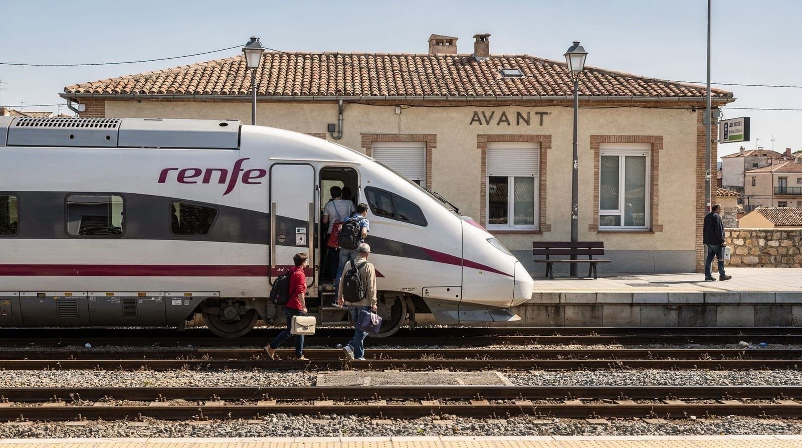
By Cercanías C-8 to Cercedilla (recommended base)
The best starting point without a car. Cercedilla is a small mountain village with several trail access points and a connection to the seasonal narrow-gauge railway (Tren de la Naturaleza).
- Departure station: Madrid Atocha or Chamartín (C-8 line)
- Arrival: Cercedilla, ~50 minutes
- Fare: ~€4–5 each way; Tourist Travel Pass may be valid
- Frequency: Check Renfe Cercanías app — less frequent than urban lines
From Cercedilla station: Trailheads begin 15–20 minutes walk from the station. The Las Dehesas recreational area is the main accessible hiking zone.
By Tren de la Naturaleza (seasonal narrow gauge)
From Cercedilla, the narrow-gauge mountain railway connects to higher altitude stations:
- El Ventorrillo (~1,500 m): Access to mid-mountain trails, pine forests, and the connection paths toward Siete Picos
- Puerto de Navacerrada (1,860 m): The main alpine pass, ski area, and starting point for Siete Picos and Peñalara approaches
Operates: Weekends and public holidays, approximately late April to early November. Check Renfe Cercanías timetables for exact dates — schedules change seasonally.
By Cercanías C-8a to Navacerrada
The C-8a suburban line extends to Navacerrada village (~1 h 20 min from Chamartín). Different from Puerto de Navacerrada (the mountain pass) — Navacerrada village sits lower and provides access to the ski resort and the El Ventorrillo trails.
By car (most flexible)
From Madrid: A-6 motorway northwest, then M-601 to Puerto de Navacerrada (1,860 m) in ~1 hour. Free parking at the Puerto. Direct road access to trailheads for Siete Picos (north) and Peñalara (south via Puerto de los Cotos).
Comparing the three main routes
| Route | Distance | Time | Difficulty | Best for |
|---|---|---|---|---|
| Las Dehesas Valley | 8–10 km | 3–4 hours | Easy | Families, first-time mountain hikers |
| Siete Picos | 10–12 km | 4–5 hours | Moderate | Views across Castile and Madrid, granite summits |
| Peñalara circuit | 12–14 km | 5–6 hours | Challenging | Glacial lakes, the highest point in the range |
Key hiking routes accessible by train
Las Dehesas Valley circuit (from Cercedilla, easy)
Distance: 8–10 km round trip | Time: 3–4 hours | Difficulty: Easy | Altitude gain: 200–300 m
From Cercedilla station, walk up through the village to the Las Dehesas recreational park. Well-marked pine forest trails in the valley; several stream crossings; good picnic spots. Suitable for families and those new to mountain hiking. No technical sections.
Siete Picos from Puerto de Navacerrada (moderate)
Distance: 10–12 km | Time: 4–5 hours | Difficulty: Moderate | Altitude gain: ~400 m
From Puerto de Navacerrada (via narrow-gauge train to Navacerrada pass), follow the Cuerda Castellana ridge path east. The Siete Picos (“Seven Peaks”) are rounded granite summits at 2,100–2,138 m — excellent views across both Castile and Madrid on clear days. Return the same way or via a lower valley path.
Important: Can be cold and windy at the top even in summer. Bring a windproof layer.
Peñalara circuit via Puerto de los Cotos (challenging)
Distance: 12–14 km | Time: 5–6 hours | Difficulty: Challenging | Altitude gain: ~700 m
The highest hike accessible by public transport (bus to Puerto de los Cotos from Cercedilla or by car). Peñalara (2,428 m) is the highest peak in the Sierra de Guadarrama and one of the most rewarding hikes near Madrid — a glacial cirque, several high-altitude lakes (Laguna Grande, Laguna Chica), and panoramic views on clear days.
By public transport from Cercedilla: Interurbana bus service connects Cercedilla to Puerto de los Cotos on some days — check availability. This route is most reliably done with a car.
Mountain villages worth stopping at
Cercedilla
The Cercanías hub for the Sierra — a pleasant mountain town with several good restaurants and bars for post-hike meals. El Aserradero restaurant (near the station) is reliable for mountain stews, lamb chops, and local wine. Bar La Estación beside the tracks handles the quick bocadillo and coffee market.
Navacerrada (village)
A ski resort village with a working-season energy during winter (December–March) and a quieter summer walking-centre character. Several restaurants around the central plaza.
Rascafría (requires car)
The most beautiful village in the Guadarrama: a 14th-century Paular monastery, cold trout streams, dense forest. 40 km from Madrid by car. No practical public transport from central Madrid.
Patones de Arriba (requires car)
A completely preserved slate-stone mountain village above the Embalse de El Atazar reservoir. 50 km from Madrid; accessible only by car or with difficulty by bus via Torrelaguna. See the Patones de Arriba destination page for the full village guide.
The Cercedilla and Navacerrada destination page and the Rascafría destination page cover the two train-adjacent and car-only village options respectively in more depth if you’re deciding where to base a longer mountain day.
Without a car vs with a car: the honest trade-off
Without a car, Cercedilla and the seasonal narrow-gauge railway give genuinely good access to Las Dehesas and, on operating days, Siete Picos via Puerto de Navacerrada. What a car adds is flexibility: direct access to Puerto de los Cotos for Peñalara, and easy stops at Rascafría’s Paular monastery or Patones de Arriba, neither of which has practical public transport. For a full comparison of which Madrid day trips need a car and which don’t, see the day trips without a car guide and the day trips by train guide.
Sierra Guadarrama in your Madrid itinerary
The Sierra works well on a summer day when Madrid’s city heat makes urban sightseeing uncomfortable — an early morning train to Cercedilla, a forest walk, lunch in a mountain restaurant, and return to Madrid for dinner. In winter, snow conditions make the Puerto de Navacerrada area atmospheric and the Siete Picos walk spectacular on clear days.
The Madrid in summer guide recommends the Sierra as the primary heat-escape option. For the overall day-trip context, see best day trips from Madrid.
For the nearby Manzanares el Real castle and reservoir, see Manzanares castle from Madrid.
Practical tips for a Sierra day hike
Weather: Check mountain weather (not Madrid city weather) at aemet.es or mountain-forecast.com for Peñalara. Summit conditions can be significantly different from the valleys. Afternoon thunderstorms are common from June–August — plan to be off exposed ridges by 14:00.
Water: Fill bottles at Cercedilla station or village fountains. Mountain streams are generally clean but the safest approach is to carry what you need (2 litres minimum for a full-day hike).
Wildlife: Iberian ibex (mountain goat) are commonly seen on rocky slopes above 1,800 m. Spanish imperial eagle nests in the Guadarrama and is occasionally visible soaring above the pines. Do not approach wildlife.
Season for snow: Reliable snow above 1,800 m from December to February most years. Variable conditions in March–April. Ice on trails at Puerto de Navacerrada can last into April — bring microspikes or trekking poles if hiking in early spring.
Emergency services: 112 for mountain rescue. The Guardia Civil has mountain rescue units stationed in Cercedilla. GPS location essential if calling emergency services in the mountain zone.
Connectivity: Mobile signal is reliable in Cercedilla and Navacerrada villages but patchy or absent on higher trails and around Peñalara — download offline maps before departing Madrid, and check your connectivity options guide if travelling from outside the EU, since relying on a live signal for navigation in the mountains is not a safe plan.
Combine a Sierra day with a longer stay using the Madrid week with day trips itinerary, which slots a mountain day alongside Toledo, Segovia and other excursions.
Frequently asked questions about Sierra de Guadarrama day trip from Madrid
Is the Sierra de Guadarrama worth a day trip from Madrid?
Yes, especially in spring (May–June) and autumn (September–October). The National Park has well-marked trails through pine forests and granite peaks. The highest accessible summit, Peñalara (2,428 m), is a 3–4 hour round trip from the Puerto de los Cotos stop. For less demanding walks, the Cercedilla valley trails are excellent and accessible directly from the train station.What hikes are accessible from Cercedilla by train?
From Cercedilla station: Las Dehesas valley walk (flat, 5 km, suitable for families), the Las Porras circuit (10 km, moderate), and the narrow-gauge train connection to El Ventorrillo (1,500 m altitude) for higher mountain access. The narrow-gauge line (Tren de la Naturaleza, seasonal) runs on weekends and public holidays from late spring to early autumn.Can I ski at Navacerrada from Madrid?
The Valdesquí ski station (near Puerto de los Cotos) is accessible from Madrid by bus (Interurbana 684 from Moncloa in winter) or by Cercanías to Cercedilla and then bus. The Alto Campoo ski area near Navacerrada resort has variable snow conditions — December to March is the season, with no guarantee of snow at lower elevations. Check conditions before travelling in winter.What wildlife can I see in the Sierra de Guadarrama?
The National Park is notable for Spanish imperial eagle, black vulture, Iberian ibex (mountain goat), red deer, and in rocky areas, the rare and endemic Iberian rock lizard. Spring and autumn mornings at higher altitudes offer the best wildlife viewing. The Peñalara glacier lake area is particularly rich for birds.Is a car necessary for the Sierra de Guadarrama?
A car makes the Sierra significantly more accessible — you can reach more trailheads, drive to Puerto de Navacerrada directly, and explore the villages of Rascafría, Manzanares el Real, and Patones easily. Without a car, the Cercanías train to Cercedilla and the seasonal narrow-gauge railway give good access to the main trails. For a focused hiking day, the train is viable.What should I bring for a Sierra de Guadarrama day hike?
Sturdy walking shoes (trails are rocky at altitude), water (2 litres minimum), sunscreen (altitude intensifies UV), layers (temperature drops 6°C for every 1,000 m gained — it can be 15°C cooler at Peñalara than at Cercedilla), and a snack. Mountain restaurants at El Ventorrillo and Navacerrada serve hot food. The weather can change rapidly — check the forecast before departure and bring a waterproof shell.