Sierra de Guadarrama
Sierra de Guadarrama National Park, 50 km north of Madrid. Hiking, skiing, Pedriza climbing, cool summer air — accessible by Cercanías from Chamartín.
Quick facts
- Distance from Madrid
- 50–80 km north (45 min–1 h by car)
- National Park status
- Since 2013
- Highest peak
- Peñalara, 2,428 m
- Cercanías access
- C-8 to Cercedilla/Cotos; C-3 to El Escorial area
- Ski resort
- Valdesquí and La Pinilla (opening Dec–Apr)
- Summer temperature
- 10–20°C cooler than Madrid at altitude
The Sierra de Guadarrama is Madrid’s backyard mountain range — a granite wall running northeast to southwest for 80 km, rising to 2,428 m at Peñalara, and separating the Meseta (the Castilian plateau where Madrid sits) from the Duero basin to the north. In summer it provides relief from Madrid’s 35–38°C heat; in winter it supplies the city’s two closest ski resorts; in spring and autumn it is one of the finest hiking areas in central Spain.
The range became a National Park in 2013 (one of Spain’s most recently designated), protecting 339,000 hectares of granite peaks, pine forests, glacial lakes, and high moorland. The flora shifts from Mediterranean scrub at lower elevations to subalpine grassland and rocky ridges above 1,800 m. The fauna includes Spanish ibex (reintroduced and now numerous on the upper slopes), red deer, golden eagle, black stork (breeding in the valley forests), and in winter occasional wolf crossings from the northern Sierra.
| Where | 50–80 km north of Madrid, Community of Madrid / Castile-Leon border |
| Cost | Train fare ~€5 each way; ski day pass ~€35–€42; hiking free |
| Time needed | Day trip (6–8 hrs); weekend for multi-day hiking |
| Getting there | Cercanías C-8 to Cercedilla/Cotos, or A-6 by car |
| Best time | May–October for hiking; December–March for snow |
How to reach the Sierra de Guadarrama from Madrid
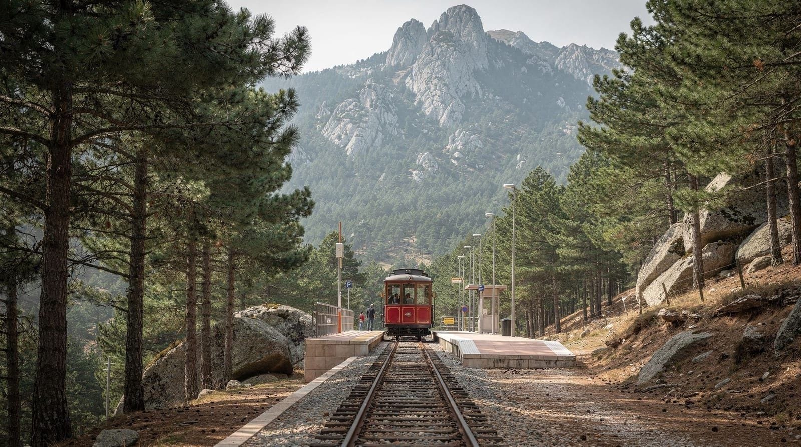
By Cercanías train: the most practical approach without a car. The C-8 line from Atocha or Chamartín runs to Cercedilla (55 minutes, Zone C, ~€5) and Puerto de Navacerrada (connects at Cercedilla via a narrow-gauge rack railway). The C-3 line from Atocha serves El Escorial (1 hour), base for several western Sierra approaches.
By car: the A-6 motorway northwest from Madrid reaches the Sierra access points in 45–60 minutes. Navacerrada pass (Puerto de Navacerrada, 1,860 m) is reached via the M-601 from Collado Villalba. Miraflores de la Sierra (base for eastern Sierra trails) via the M-607.
Important note: on summer weekends, the main Sierra access roads (especially the Navacerrada pass road) can be heavily congested by Madrid residents escaping the heat. The train is significantly faster and stress-free for these days.
Key hiking areas
Peñalara and the Glacial Lakes
The Peñalara massif (2,428 m) is the highest point in the Sierra and the centre of the most protected zone of the National Park. The main trail from the Cotos pass (1,830 m, reached by rack railway from Cercedilla) ascends Peñalara in about 2.5 hours each way — a 4–5 hour round trip with 600 m of elevation gain on clear trails. The summit views extend to Toledo to the south, the Duero basin to the north, and on clear days the Picos de Europa 300 km away.
The route passes the Lagunas de Peñalara — a chain of glacial lakes at 1,900–2,000 m, the most southerly glacial landscape in the Iberian Peninsula, still harbouring endemic aquatic species and a breeding ground for the Pyrenean frog. Access to the lake perimeter requires a free permit (obtainable at the Cotos visitor centre, often available on the day except on summer weekends).
La Pedriza
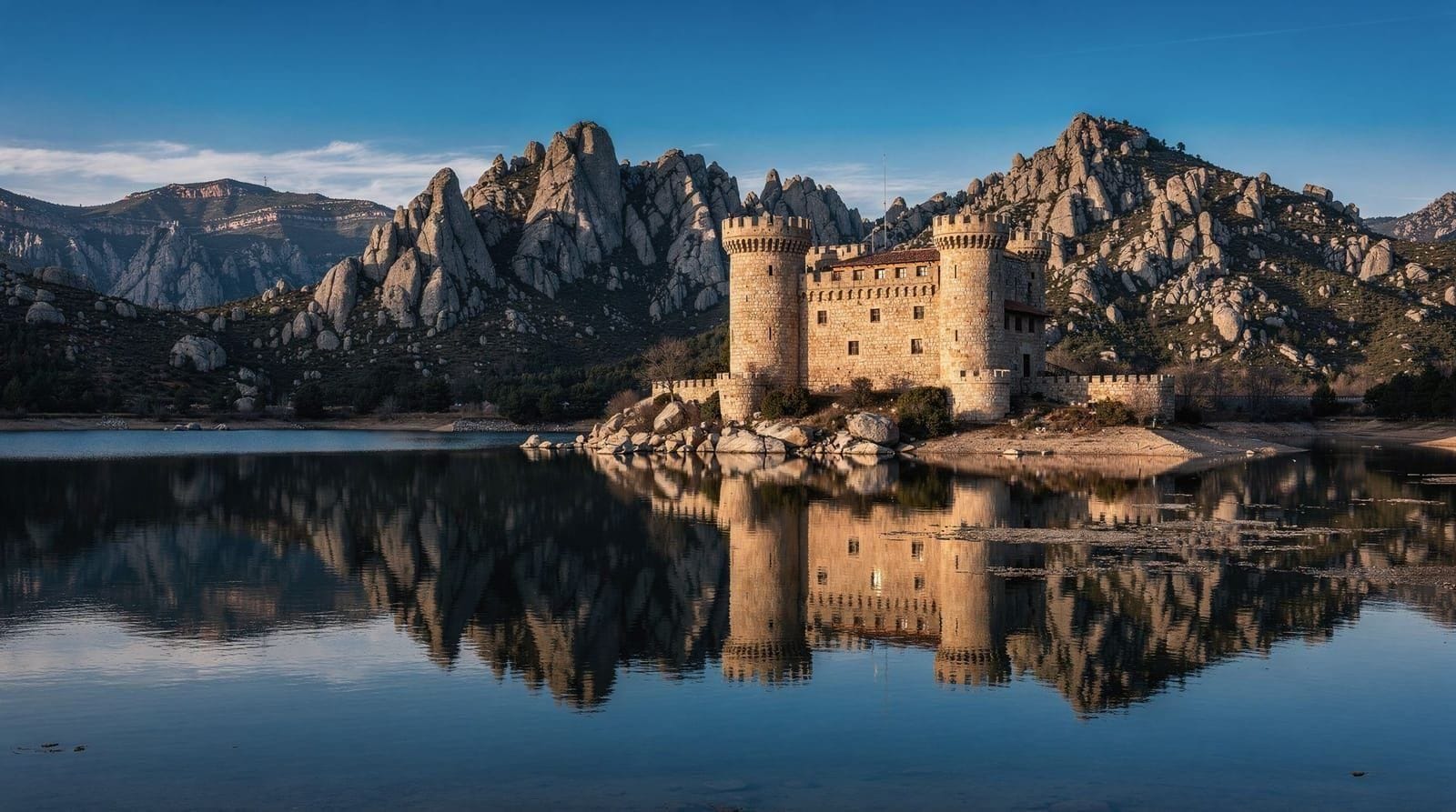
La Pedriza is a granite massif south of Manzanares el Real, characterised by massive boulders, spires, and eroded formations that make it one of Spain’s premier rock climbing areas (over 1,000 marked routes). Hikers without climbing equipment can access the main valley trails, including the approach to the Yelmo peak (1,717 m), a distinctive granite tor with 360-degree views. The Pedriza is the access point for Manzanares el Real — the castle and reservoir are at its foot.
Cuerda Larga ridge
The Cuerda Larga is the main ridge of the Sierra, running 25 km along the central spine above 2,000 m. It is accessible at several points by car or on foot from the southern slopes. The most popular section starts at the Navacerrada pass and follows the ridge east. The ridge walk is exposed and requires good footwear; in clear conditions the panoramic views over both sides of the Sierra (Madrid side and Segovia side) are exceptional.
Skiing in the Sierra de Guadarrama
Madrid’s nearest ski resorts are in the Sierra, accessible for a day trip that is unusual among European capital cities:
Valdesquí (Puerto de Cotos, 1,830 m base): the larger of the two resorts, with 22 pistes covering 29 km, lifts up to 2,200 m. Accessible by Cercanías C-8 from Chamartín to Cercedilla, then rack railway to Cotos (total about 1 hour 45 minutes from central Madrid). Day pass ~€35–€42; rental equipment available on-site.
La Pinilla (Riaza area, eastern Sierra): 32 km of piste, more reliable snowfall, requires a car (1.5 hours from Madrid via the A-1). More local, less crowded than Navacerrada.
The season typically runs December–March/April, snow-permitting. At this latitude (40°N) at 1,800–2,200 m, snow is not guaranteed in warm years but most winters produce 4–8 weeks of skiable conditions.
Wildlife watching
The National Park is one of the most accessible wildlife-watching destinations for Madrid residents. Key species and where to find them:
Spanish ibex (cabra montés): the Pedriza and Peñalara massifs have the highest density. Rocky slopes above 1,500 m year-round; large herds visible on the Navacerrada pass road in early morning.
Red deer (ciervo): the valley forests around Rascafría and the Paular valley. The autumn rut (late September–October) brings spectacular encounters; the bellowing carries for kilometres.
Golden eagle (águila real): nesting pairs throughout the high Sierra; best spotted on thermals above rocky ridges mid-morning.
Black stork (cigüeña negra): breeding in the Tagus headwaters valley (Rascafría area) and around La Pedriza. One of the most elusive breeding birds in Spain; patient observers in the right habitat are rewarded.
Griffon vulture (buitre leonado): large soaring groups above the rocky gorges near Patones and the Tagus headwaters.
When to go: a season-by-season view
| Season | Conditions | Best for |
|---|---|---|
| Spring (Mar–May) | Snowmelt, wildflowers, streams full | Waterfalls, moderate hikes below 1,800 m |
| Summer (Jun–Aug) | 10–20°C cooler than Madrid at altitude | Ridge hiking, glacial lakes, escaping the heat |
| Autumn (Sep–Nov) | Cool, clear light, deer rut late Sep–Oct | Wildlife watching, Rascafría valley colours |
| Winter (Dec–Mar) | Snow above 1,800 m, cold at altitude | Skiing at Valdesquí or La Pinilla, snowshoeing |
Late spring and early autumn give the most reliable combination of clear trails and manageable temperatures; a July or August weekday morning start is the practical alternative if a summer visit is the only option, since afternoon cloud and heat build quickly above 1,500 m.
The Bourbon trail in the Sierra
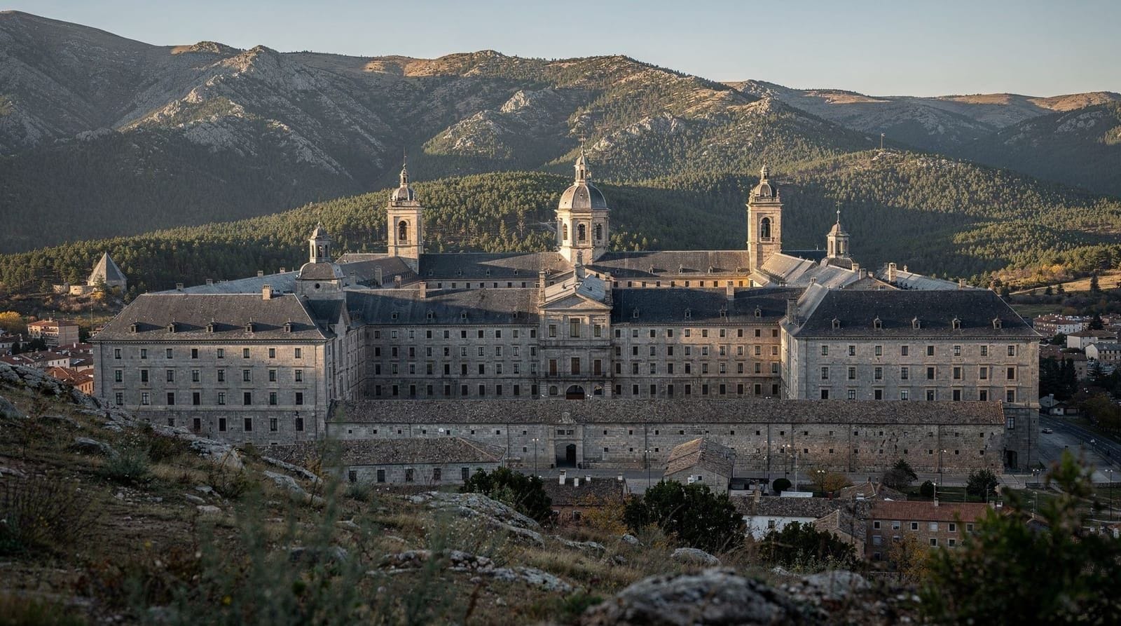
The Sierra de Guadarrama’s historical relationship to Madrid royalty is layered across the landscape. The Real Sitio de El Escorial (the monastery-palace of Philip II) was placed deliberately at the Sierra’s foot for access to hunting grounds. The roads built by the Bourbons to connect their palaces — Madrid, El Escorial, Aranjuez, La Granja de San Ildefonso — all cross the Sierra at different points. The Puerto de Guadarrama (the main road pass) and the Puerto de Navacerrada (the railway pass) both carry the traces of this royal infrastructure.
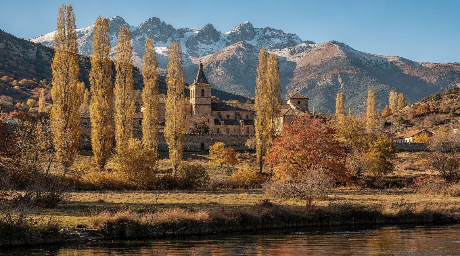
The village of Rascafría at the head of the Lozoya valley was founded around the Real Monasterio de El Paular — a Carthusian monastery from 1390, now partially a hotel (part of the Parador chain) — and represents the human settlement pattern at altitude: valley-floor agriculture, monastery, mountain pasture. See Rascafría for more detail.
Practical information
What to bring: the mountain weather changes faster than you expect. Even in July, temperatures above 2,000 m can drop to 10°C in the afternoon with cloud development. A lightweight waterproof layer, sun protection, and 2 litres of water per person are the minimum for any ridge walk.
Parking: the Navacerrada pass car parks fill by 10:00 on summer weekends. Using the train from Chamartín to Cercedilla and the rack railway is faster and less stressful.
Maps: the CNIG (Spain’s national cartographic institute) produces 1:25,000 maps of the Sierra that are the standard for serious hiking. The free IGN app provides these digitally with GPS tracking.
For Madrid in summer: the Sierra is the primary escape from summer heat, and a morning in the mountains before returning to the city for evening tapas is a perfectly normal Madrid resident’s summer Saturday. See also parks and outdoor Madrid for urban green options.
Which base village to use
The Sierra has no single “gateway town” the way Segovia or Toledo has a single old-town centre — where you base yourself depends on which part of the range you want. Cercedilla, the end of the C-8 Cercanías line, is the practical choice for anyone without a car: it has the rack railway up to Cotos/Navacerrada, a handful of hiking-outfitter shops, and simple restaurants aimed at day hikers. Cercedilla and Navacerrada together form the most train-accessible cluster of trailheads in the range. Manzanares el Real, at the foot of La Pedriza, suits climbers and anyone combining the castle and reservoir with a shorter walk — but it requires a car or bus, not the Cercanías. Rascafría, in the Lozoya valley on the north side of the range, is quieter and better for a slower, overnight visit; it has no direct rail link, only a bus from Madrid’s Plaza de Castilla, making it a full commitment rather than a quick day trip.
For those without their own transport, day trips without a car covers the Sierra alongside Madrid’s other train- and bus-accessible excursions, and is worth checking before assuming a hire car is necessary.
Combining the Sierra with El Escorial
Because the A-6 and the C-3 Cercanías line both pass El Escorial on the way toward the western Sierra, it is straightforward to combine a morning at the monastery-palace with an afternoon in the mountains above it — the Sierra access points near Cercedilla and the Guadarrama pass are 20–30 minutes further by road. This works better with a car than by train, since the Cercanías lines to El Escorial (C-3) and to Cercedilla (C-8) are different routes requiring a change back through Madrid. See El Escorial from Madrid for the monastery logistics, and the best time to visit guide for how the Sierra’s cooler microclimate affects planning across the year.
Frequently asked questions about the Sierra de Guadarrama
Do I need a car to visit the Sierra de Guadarrama?
No. The Cercanías C-8 line from Chamartín reaches Cercedilla in under an hour, connecting via a rack railway to the Cotos and Navacerrada passes — the main hiking and ski-access points. A car gives more flexibility for La Pedriza, Rascafría, or La Pinilla ski resort, but the core hiking and skiing at Valdesquí are fully reachable by train.
Is the Sierra de Guadarrama good for a half-day trip from Madrid?
It works better as a full day (6–8 hours) given the train and rack-railway journey time each way, but a half-day is possible if you stay close to Cercedilla or Cotos and keep the hike short. For a genuine mountain experience — a summit like Peñalara, or a proper wildlife-watching session — a full day is the realistic minimum.
What should I pack for a Sierra day trip?
A waterproof layer even in summer, sturdy footwear, sun protection, and at least 2 litres of water per person — mountain weather changes faster than the Madrid forecast suggests, and afternoon temperatures above 2,000 m can drop 10–15°C from the morning. See the practical section above for the full list.